Chart 12323

Chart 12326
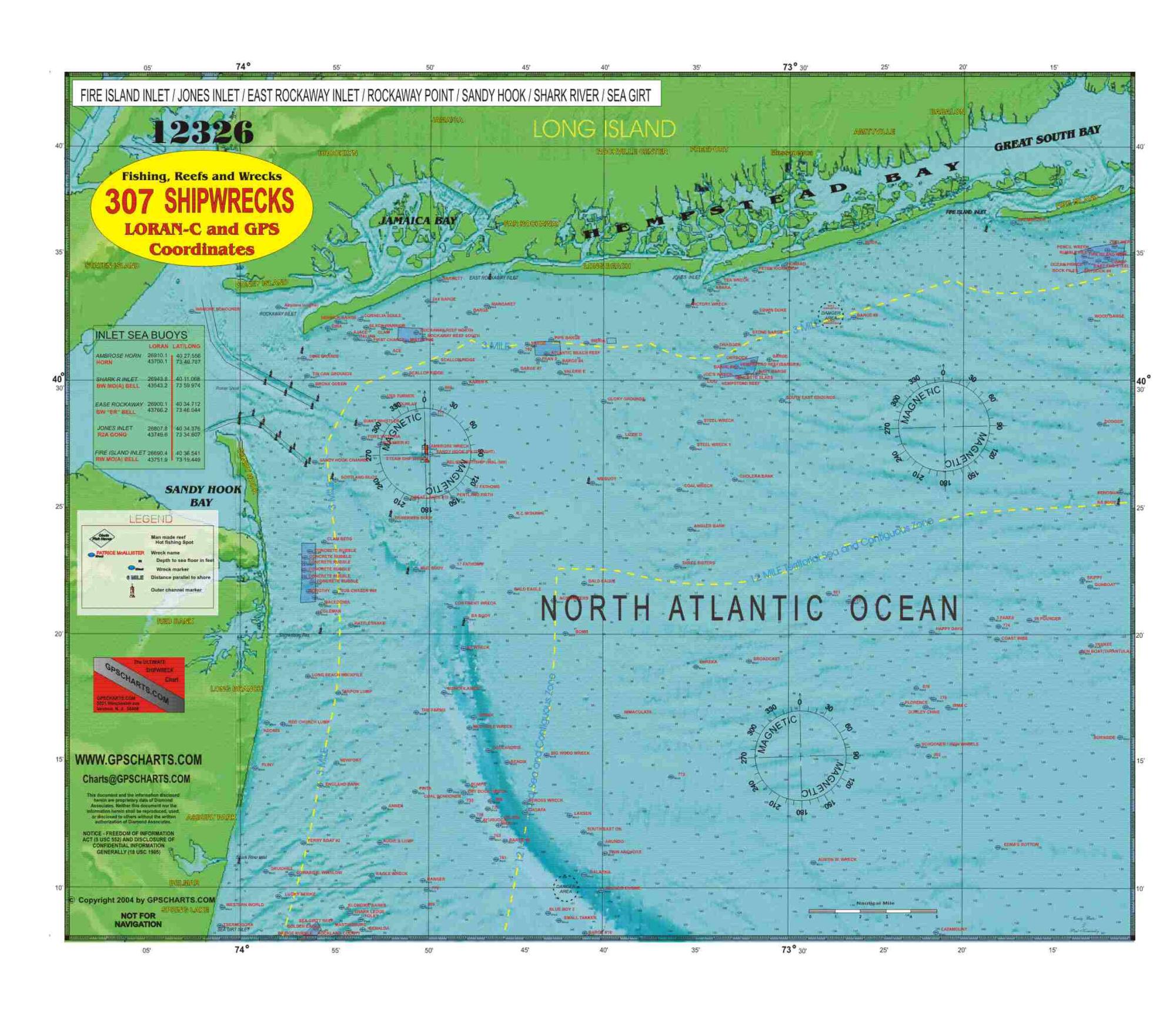
FIRE ISLAND to SEA GIRT INLET has over 307+ wrecks. This is what we call our sandy hook chart, it covers from fire Island on Long Island to sea girt inlet in New Jersey. The charts are fully laminated with money back guarantee. Some of the features on our charts include, locations of inlet sea buoys, compass rose, 3 mile and 12 mile zones, danger and caution areas and of course all charted Wrecks

SEA GIRT to LITTLE EGG CHART there are 331 + wrecks.This is our central New Jersey chart, it covers from SeaGirt to Little beach. The charts are fully laminated with a money back guarantee. Some of the features on our charts include, locations of inlet sea buoys, compass rose, 3 mile and 12 mile zones, danger and caution areas and of course all the Wrecks
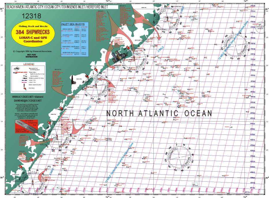
BEACH HAVEN to HEREFORD INLET has over 334+ wrecksThis is our South Jersey chart, it covers from Little beach to Wildwood New Jersey. The charts are fully laminated with a money back guarantee. Some of the features on our charts include, locations of inlet sea buoys, compass rose, 3 mile and 12 mile zones, danger and caution areas and of course all the Wrecks.
Chart 12318
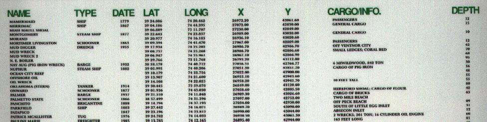
GPS and LORAN C Coordinates
Compare your old Loran-c numbers.
This is just a small sample of the back of the chart. All wrecks are listed.